
16th C entury
In the returns of 1564 Barling was second only to Leigh throughout Essex having 23 ships with 48 marines and fishermen. In 1565 Wakering was returned as a seaport and Little Wakering built 6 vessels in the 1580’s under a bounty scheme. These small ports were well sheltered and traded with the Low Countries and London in the days when the lack of a good road network made the waterways a far more viable form of cargo transport. The main cargoes were grain, timber, wool and oysters.
As the islands expanded, so the marine role of the area declined. Sea trading tended to switch from the now, inland Great Wakering to Barling and a new nucleus north of Little Wakering church down by the creek. The marshes did tend to increase the agricultural area as they provided extra grazing area for sheep, and the higher areas could be cultivated once the rain had washed out the salt. As late as 1595 John Norden described the area as having: ‘Milk, butter and cheese in admirable abundance and in these parts are the great and huge cheeses made, wondered at for their massiveness and thickness.
History of the District of Wakering by Century
11th Centu ry
ry
The area known as Essex to which the Normans came in 1066 had been settled by the Saxons for over 500 years and nearly all of the 840 villages and hamlets bore the Saxon names which survive today. Most of the village names are recorded in the Domesday Book of 1086: Wachelinga (Great Wakering) had 2 villeins and 18 bordars (fishermen and wildfowlers) – probably representing a population of 80-90 persons – with wood for 90 swine, pasture for 300 sheep and two plough teams; Wacheringa (Little Wakering) had 1 freeman, 1 bordar (although increased to 10 at the time of the survey) and 15 serfs with grazing for over 100 sheep; Barlinga (Barling) had 2 villeins and 9 bordars and pasture for 40 sheep.
There were a total of 14,600 households in Essex at this time with over 25% of the households occupying the largest villages, the other 75% forming small villages and hamlets with fewer than 20 people in each. Roman remains and field boundaries being found in the area suggests that Great Wakering, Little Wakering and Barling may even date back to Roman times. What is more certain is that the suffix "-ing" is an early Saxon ending dating from before 500 AD. Indeed it is suggested that the area was settled by an East Saxon tribe the "Waeccer", although Waeccer has been claimed as a typical eighth Century Norse name. Certainly Norse tribes were very active in the area as Havengore has a typical Norse ending (Gore meaning muddy).
12th Cen tury
tury
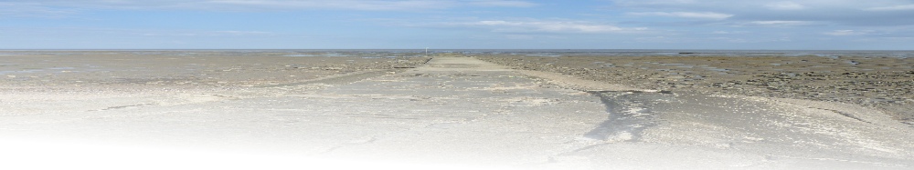
Salt marshes formed naturally as the salt laden River Roach and River Crouch lost energy on meeting the steadily rising incoming sea. The marshes were crucial for sheep pasture and they became so valuable that they were divided among mainland manors. Foulness was split between 5 parishes including Wakering and Potton Island was divided between Great Wakering and Little Wakering. The sheep provided wool and meat but chiefly it was their milk for cheese that was valued.
The marshes were greatly increased by reclamation and enclosure and their silt banks were then further stabilised and colonised by salt resistant vegetation. Eventually the banks were built up above low tide, and so could be turned over to farming. Earth walls were usually constructed to enclose small sections or ‘ innings’. This produced a patchwork of fields but also provided ‘ bulk heads’ against floods.Besides grazing, the marsh and mudflats of the area offered wildfowl, shellfish and fish. Fish traps and weirs were built out on the mudflats, and trapped fish on an ebbing tide. Also great lines of hooks were fixed out on the mudflats at low tide. Many of the Wakering families fished out around foulness. The same families operated many of these for many years and in a period when fresh meat was virtually unknown in winter, this was a vital source of protein.
13th C entury
In the year 1210, a law was passed placing the responsibility of maintaining sea defences upon the farmers whose fields they protected. The main ‘islands’ of the district became known as distinct entities: Wallasea Island in 1229 Havengore Island in 1230 Foulness Island in 1235 Potton Island in 1244.
The chancel of St Nicholas church in Great Wakering has lancet windows of the 13th century. The church itself is built of rag stone, septaria and flint and has a Norman tower and Tudor broach spire. Against the tower is an unusual Tudor two storey porch. It may have been erected for the priest who came to minister from Beeleigh Priory.
14th C entury
In 1326 victuals and timber were shipped from the Manor at Great Wakering. Over 50 various commissions visited the area to ensure that the sea defences were adequate. Much of the embanking and reclamation of the 12th Century forced much channelling of the water, therefore eroding the embankments. As the sea level rose and the area sank, flooding became an increasingly major threat.
In 1381 Wakering men were involved in the Peasants Revolt against Royalty and the Government. The Peasants Revolt united all social divisions beneath the landlord and was truly a revolt of all the common people. It developed from a mixture of national, local and individual reasons. On 7th June 1381 in Great Wakering, messengers incited local men to action. A John Buck took a cart on the 12th June 1381 and said that Sir Robert Hales was coming with 100 Lancers. (Sir Robert Hales was the Government’s Treasurer – and unpopular national figure, with lands in Essex.) Court Rolls (records) were burned at the Manor of Wakering Hall, Little Wakering. On 13th June 1381 men of Essex marched through the city of London. On 14th June 1381, the rebels broke into the Tower of London, and beheaded Sir Robert Hales, setting his head upon a pole on London Bridge.
15th C entury
By the 15th Century probably a quarter of the area was under cultivation with the chief crops being wheat and oats. Whilst the low wet marshes produced grass virtually all year and with a high degree of nutrition sheep were bred as sources of leather and skins for parchment but the pasture was not ideal.
The sheep could cope not with the high salt content of this pasture and the area became a breeding ground for foot rot. In 1424 of the 1,437 ewes on Foulness 118 were sick with foot rot and to counter this a mixture of tar and butter was smeared onto the sheep’s feet.
17th  Century
Opposite Little Wakering church stands a terrace of 17th century dormer cottages. The church itself dates from the 11th century, but was largely rebuilt by John De Wakering, Bishop of Norwich.
The Royal Arms of George III are displayed in the tower having visited the church in 1769. Farming in the area was greatly expanded during the seventeenth century, probably with arable farming accounting for more than 50%, particularly with more wheat being produced. On Foulness Island stands the George and Dragon a 17th Century public house situated on Ministry of Defence property. It's walled garden was once the area for bare fist fighting and the island dates back to Roman times. It is possible to visit the pub by ringing the landlords, Fred & Relda Farenden on 01702-219460 stating your name and the number of passengers in the car and your approximate time of arrival. Security will then be contacted on your behalf and permits issued to visit the pub.
Once through security you are restricted to the road that leads to Churchend and you are not allowed to stray from the road or visit the other village on the island (their pub closed around 8 years ago).
18th Ce ntury
ntury
Arable farming exceeded pastoral farming throughout the area, even on Foulness and this led to an agricultural revolution in the area. Probably this increase was partly a result of the break up of manorial agricultural and the leasing of the marshes to tenant farmers but also partly due to the increasing demand for fresh food from the now rapidly growing City of London. Hence scores of minor landing places enjoyed busy trade due to the high cost of road transport.
The oyster trade became of major importance in the 18th Century using the numerous pits or lay ins that lined the creeks.By 1777 the area resembled the pattern shown today. The emphasis has shifted from fish and sheep to the more prosperous arable areas. A stock mill was erected at Barling to process the grain. Most of the islands were now arable areas and the last island Rushley was reclaimed in 1781 by Harriott who long battled to turn it over to the plough.
There was much smuggling and wrecking on the Maplin Sands and Foulness Island became infamous as a refuge for wanted criminals for a long time. Flood and disease were major fears, especially in low marshy areas, where insects could breed in stagnant water pools. The insects carried a type of malaria ‘marsh ague’, which produced a high death rate, especially among outsiders who had not built up a resistance to the insect bites.
As late as 1790 it was noted that many local men had between 6 and 14 wives one after the other. If they married women from outside the marsh their wives rarely lasted a year before falling prey to the insect bites. Also because of the lack of sufficient drinking water, especially on the islands, disease was spread all too easily. Despite this, the area survived a peaceful existence as a farming community.
19th C entury
Rural calm changed to stagnation during the 19th Century since the area was always on the periphery of any future developments and badly lacked industry. As the Century progressed the lack of reliable land transport retarded development so much that from 1801 to 1891 the population of Great Wakering grew by only 550.
Over the same period the essentially farming communities of Little Wakering and Barling grew by only 100 in contrast to South Shoebury which grew by 2900. South Shoebury had grown from a population of 100 in 1801 to over 1500 by 1861 and to 3,000 by 1891 following the arrival of the railway. In contrast, by 1847, 80% of the farmland was still arable – especially wheat. The climate was excellent for cereals. The cold winters break up the soil and kill any pests whilst the hot sunny summers ripen the crops whilst the conventional rain swells the grain. Rainfall was low (21") as the area is in the rain shadow of the rest of Britain (from the wet south-westerly winds) and so abundant sunshine ripens the grain.
Wakering area was male dominated mainly because of the harsh agricultural environment and women sought employment in service roles or moved to the rapidly growing resort of Southend for employment. The 1841 census records the population having 43% under 20 and in 1811 a survey found as many as 10 persons per dwelling (and these averaged only 4 rooms). The birth rate was high, as was the female death rate from their exhausting life. By 1861 the population of Great Wakering had risen by 114 and in 1863 several local fields in South Shoebury and Wakering were used as Brickfields. Collectively they were developed by J. Catmole and later taken over by Milton Hall Brick Company Limited and by 1881 South Shoebury Brickfield was producing 20 million bricks a year, employing over 1000 workers.
20th C entury
In 1900 the War department established ranges on Foulness Island and in 1915 purchased the manor and two thirds of the island. In 1922 the Military Road was built from Great Wakering to Foulness (previously the only way on to the island by road was via the very hazardous Broomway) and army housing was built in Wakering. By 1932 both the population and services had increased and Great Wakering Brick Works was opened at Star Lane with production quickly rising to 13 million bricks per year. The 1950’s saw a resurgence of agriculture with an expansion of market gardening and dairying for the vast Southend market.
Foulness was now producing some of the highest wheat yields in Britain. Farms were enlarged and mechanised with less labour now being needed from the villages and traditional farming was becoming a thing of the past. The floods of 1953 brought so much devastation to the area that Foulness Island was cut off for 2 days and the other islands were flooded when over 200 breaches were made in the local sea wall. The salt water ruined much of the land. The damage was so bad that in 1955 the Ministry of Defence purchased a now desolate Potton Island to be used as blast and fragmentation ranges. The greatest change has occurred since the 1960’s, as the area has become a growing residential area as an overspill area for the increasingly saturated Southend area.


© 2015 - Richard Kirton - All Rights Reserved | Privacy Policy | Terms of Use | Site Map